Detail and Contour Surveys
You are here:

Summit Geomatic have prepared thousands of contour and detail surveys over the years.

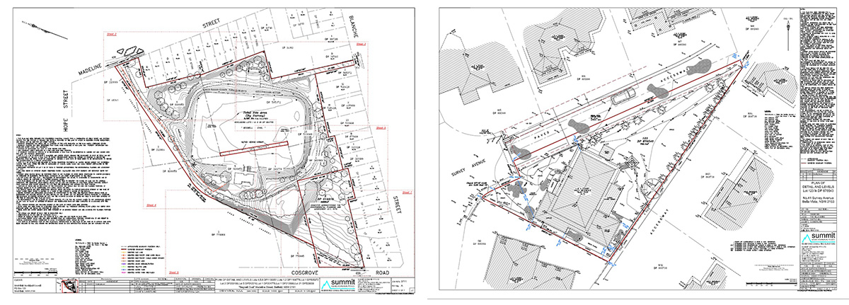
Summit Geomatic have prepared thousands of contour and detail surveys over the years. Detail surveys are a basic prerequisite for building and land development, and in most cases, their purpose is to indicate features on, and adjacent to, a property.

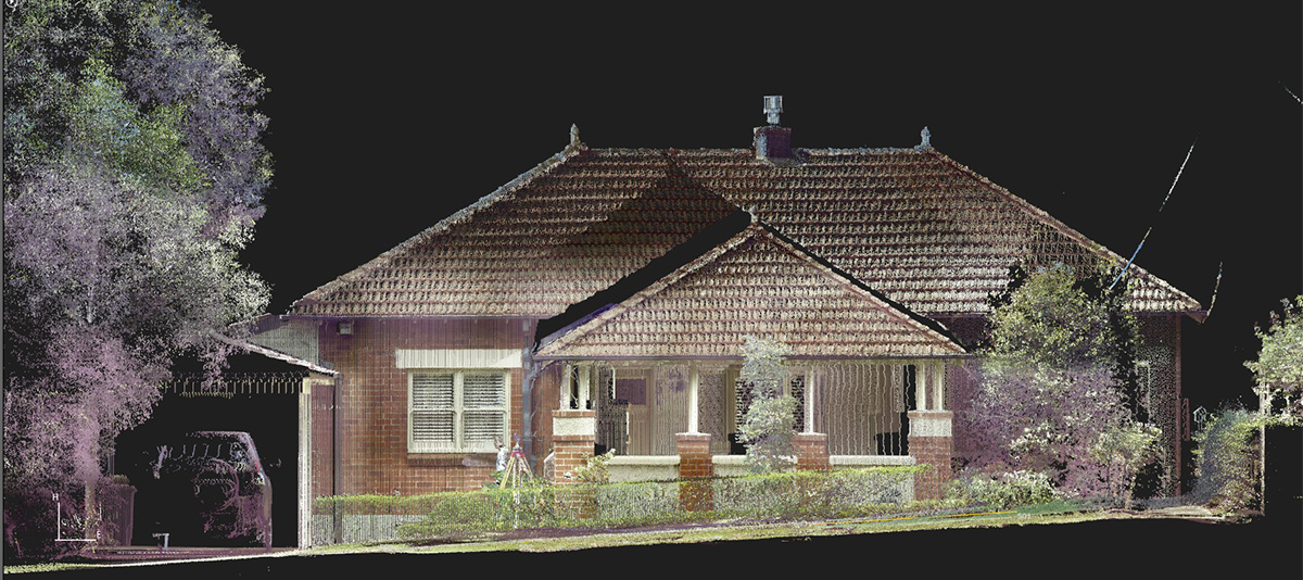
There are a number of site features and levels required by architects and planners. A topographic survey is a vital component of a successful development application for any development of your land. We can undertake topographic surveys using a range of technologies, from remote access reflectorless Total Stations and 3D scanners (for restricted access) to GPS technology (large-scale topographic surveys).

Features of general detail surveys include:

  • Title information
  • Contours
  • Spot levels
  • Site co-ordination and location of true north
  • Levels on the kerb and other critical features
  • Location of existing visible services (sewerage, power poles, telephone)
  • Ridge and gutter heights for subject buildings
  • Ridge and gutter heights for adjacent buildings
  • Outline of adjacent buildings
  • Window position and heights for adjacent buildings facing the subject site
  • Height and width of major vegetation
  • Floor level of subject property
  • Location of ancillary structures (garden sheds, pergolas)
  • Level benchmark to Australian Height Datum (AHD) where applicable.

Summit Geomatic can also survey any other feature of a site that may impact upon its development potential. Site detail extras may include accurate boundary definition, boundary marking, and a services search. Furthermore, we can also provide highly accurate internal surveys of buildings to portray room layouts or show design purposes.

Examples of Summit Geomatic surveys

More services

We handle all types of surveying requirements across the city and throughout New South Wales

  • Boundary Marking
  • House Set-out
  • Identification Surveys
  • Urban & Rural Subdivision
  • Strata Title Subdivision
  • Cadastral Plans
  • Spot Level & Contour Surveys
  • For Planning & Development
  • Connection to AHD
  • Site Establishment
  • Construction Set-out
  • Monitoring & Control
  • Telecommunication Sites
  • Lease & Survey Information Plans
  • Site Coordination

Contact us for a no-obligation fee proposal for your next project.